Major Streams: West Branch Delaware
River
Introduction
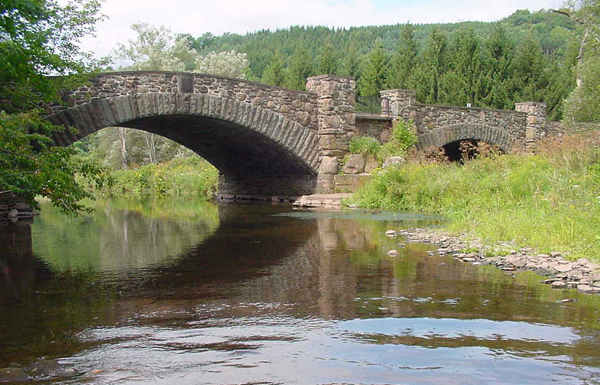
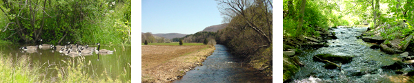
The West Branch Delaware River and its tributaries are the source
waters for the Cannonsville Reservoir, part of the Catskill/Delaware
drinking water supply system for New York City. The watershed
above the Cannonsville Reservoir encompasses an area of 353 square
miles with approximately 662 linear miles of rivers and streams.
This predominantly forested and agricultural watershed represents
a sizeable and challenging resource to comprehensively manage.
Stream walkover observations and assessments suggest that the
West Branch Delaware River has a tendency to become shallower
and wider that is desirable due to increased sediment supply from
excessive bank and bed erosion in the main river and its tributaries.
While erosion and deposition are natural processes, many management
activities can significantly increase erosion rates that in turn
contribute to increases in sediment supply. These conditions demonstrate
the need for comprehensive management and stewardship by all stakeholders.
Maps
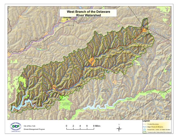
Click
here for a larger view of the above map
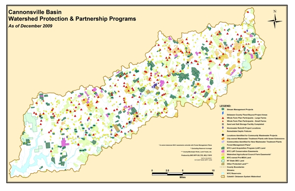
Click
here for a larger view of the above map
Delaware Watershed Stream Management Grant Program (Click Here)
The Delaware Watershed Stream Management Grant Program offers assistance to local communities, residents, and organizations to advance recommendations from the East and West Branch Delaware River Stream Corridor Management Plans. Categories of funding include: Flood Management, Highway and Infrastructure Improvement, Stormwater Implementation and/or Critical Area Seedling, Recreation-Based Opportunities or Habitat Enhancements, General Restoration Projects, Education/Outreach/Training, on Watershed Protection, and Planning & Assessment.
USGS Gage Links
The United States Geological Survey (USGS) maintains 11 continuous-recording
stream gages in the West Branch Delaware River watershed above
the Reservoir. These gages measure the stage, or height, of the
water surface at a specific location, updating the measurement
every 15 minutes. Click on the Station ID number of your gage
of interest to receive real-time water surface data from USGS.
| Station
ID |
Station
Name |
Drainage
Area (Mi_) |
Current
Period of Record |
| 01421610 |
WEST BRANCH DELAWARE RIVER AT HOBART |
15.5 |
Aug 2000 - present |
| 01421614 |
TOWN BROOK TRIBUTARY SOUTHEAST OF HOBART |
0.76 |
Oct 1998 - June 2009 |
| 01421618 |
TOWN BROOK SOUTHEAST OF HOBART |
14.3 |
Oct 1997 - present |
| 01421900 |
W BR DELAWARE RIVER UPSTREAM FROM DELHI |
134 |
Dec 1996 - present |
| 01422389 |
COULTER BROOK NEAR BOVINA CENTER |
0.76 |
Oct 1997 - June 2009 |
| 01422500 |
LITTLE DELAWARE RIVER NEAR DELHI |
49.8 |
Jan 1997 - present |
| 01422738 |
WOLF CREEK AT MUNDALE |
0.61 |
Oct 1998 - June 2009 |
| 01422747 |
EAST BROOK EAST OF WALTON |
24.7 |
Oct 1998 - present |
| 01423000 |
WEST BRANCH DELAWARE RIVER AT WALTON |
332 |
Oct 1950 - present |
| 0142400103 |
TROUT CREEK NEAR TROUT CREEK |
20.2 |
Dec 1996 - present |
| 01424108 |
SHERRUCK BROOK TRIBUTARY NEAR TROUT CREEK |
1.26 |
Oct 1997 - Sept 2007 |
Demonstration Restoration Projects
Click
here for Stream Restoration Projects in the West Branch of the
Delaware River Watershed
Stream Management Plans
Click
here for Intro and links to Stream Management Plans
Delaware Basin Action Plan(s)
Action Plan to Guide Stream Management Plan Implementation in the WB Delaware Watershed, 2009-2011
Action Plan to Guide Stream Management Plan Implementation in the WB Delaware Watershed, 2011-2013
Action Plan to Guide Stream Management Plan Implementation in the WB Delaware Watershed, 2013-2015
Basin Specific Studies
Click
here for Delaware County Community Mapping Tool
Click here for Delaware
County Multi-Jurisdictional Hazard Mitigation Plan
Click here for thesis on Alternative Futures For Headwater Stream and Wetland Landscapes in the Upper Delaware Basin, New York, 2009
Contact Information
Delaware County SWCD • Rick Weidenbach: (607) 865-7161
NYC DEP Stream Management • Beth Reichheld: (845) 340-7838
Delaware County Planning • Shelly Johnson: (607) 746-2944
Watershed Agricultural Council • Tom O’Brien: (607)
865-7790
Click
here for Delaware Riverkeeper |