Introduction
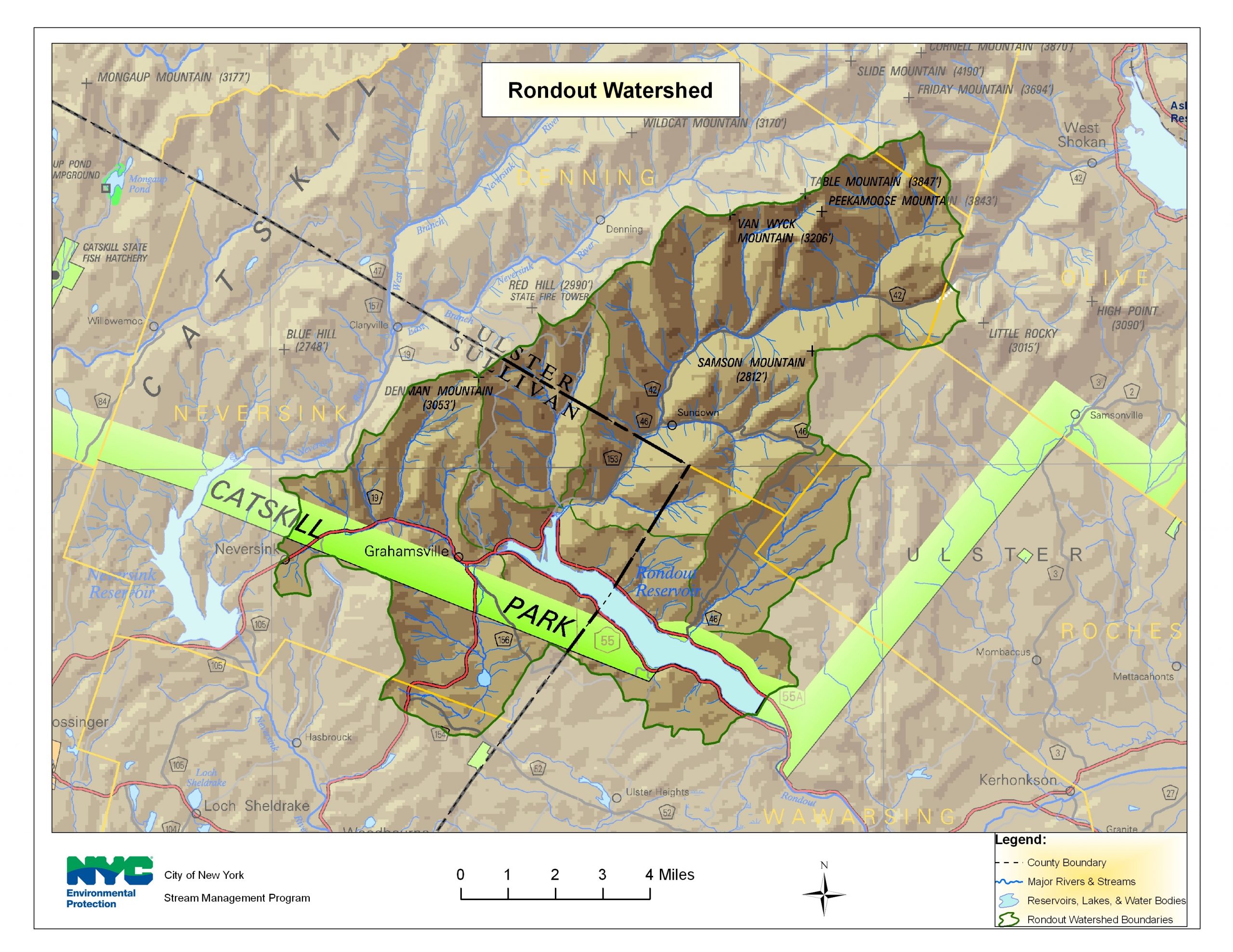
Encompassing approximately 95 square miles, the Rondout Reservoir watershed, is located primarily in Sullivan and Ulster County, NY. The Rondout Reservoir watershed drains mainly two towns – Denning in Ulster County and Neversink in Sullivan County. Small portions of Rochester, Wawarsing, Shandaken and Olive (Ulster) and Fallsburg (Sullivan) are also within the reservoir watershed. The lowest elevation within the watershed is 840 ft at the reservoir and the highest point is near the headwaters of the Rondout Creek at 3,837 ft. The primary tributaries that drain into the Rondout Reservoir are the Chestnut Creek, Trout Creek, Red Brook, Sugarloaf Brook and Rondout Creek. Streams in the Rondout valley are primarily perennial streams, that is, they flow year-round except in smaller headwater streams or in rare, extreme drought conditions.
In order to meet both surface and groundwater needs, both quality and quantity, it was determined that a comprehensive watershed approach was required to document the magnitude of potential impairments and involve watershed stakeholders in recommending strategies for remediation and management. To date, the Sullivan County Soil and Water Conservation District (SCSWCD) and New York City Department of Environmental Protection (NYCDEP) have completed a stream management plan for the Chestnut Creek and a demonstration restoration project behind the Neversink Town Hall. NYCDEP has plans to conduct a similar study within the Rondout Creek watershed in upcoming years.


