Schoharie Creek Management Plan
The Schoharie Creek Management Plan was designed as a comprehensive review of stream characteristics, data, maps and presents recommended management strategies. The management strategies consist of measures that can be taken individually and collectively to reduce the flood risks associated with living in the Schoharie valley, improve the ecology of the stream and floodplain, while protecting the stream’s many resource values. Ultimately, the plan is meant to assist watershed municipalities and residents in planning for a sustainable future for their property, infrastructure, water and biological resources. Ensuring the health of the watershed’s environmental resources will also help to secure a future of prosperous economic growth and a good quality of life for watershed residents.
Section 1
Table of Contents, Preface and Acknowledgements
Introduction & Goals
Section 2 - Schoharie Creek Natural and Institutional Resources (Complete Section (3.6 MB))
This section provides watershed background information and characteristics which influence the Schoharie Creek. A chapter on living streamside and stream related activities may be of particular interest to landowners, answering commonly asked questions, including necessary permits and agency contacts, relating to activities which may impact stream health or stability.
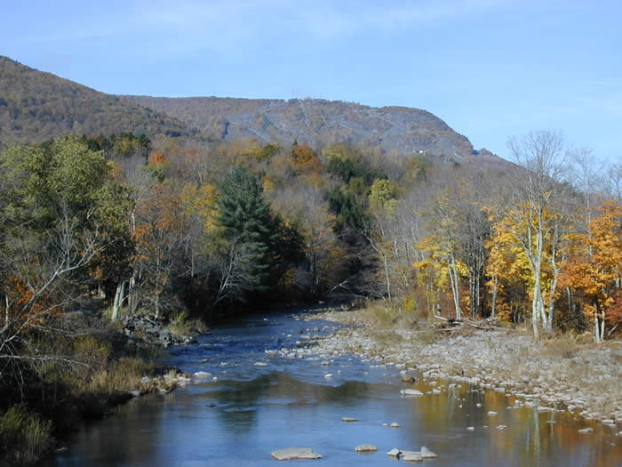
2.1 Regional Setting
2.2 Watershed History
2.3 Physical Geography
2.4 Hydrology and Flood History
2.5 Watershed Geology
2.6 Wetlands & Floodplains
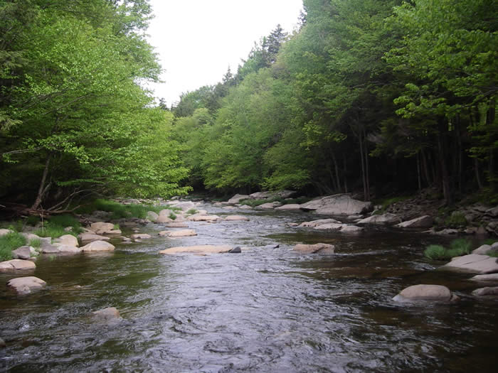
2.7 Riparian Vegetation
2.8 Landuse/Landcover
2.9 Fisheries & Wildlife
2.10 Recreational Opportunities
Recreation Opportunity Map
2.11 Stakeholders
2.12 Agency Contacts and Program Resources
2.13 Permit Requirements
Section 3 - Watershed Inventory and Assessment (Complete Section (1.3 MB))
This section includes a summary of water quality assessments that have been undertaken over the years in the Schoharie Creek, an introduction to the science of stream processes, and a description of the watershed assessment protocol used to develop this stream management plan.
3.1 Water Quality Assessment
3.2 Introduction to Stream Processes
3.3 Watershed Inventory & Assessment
Section 4 - Management Unit Descriptions
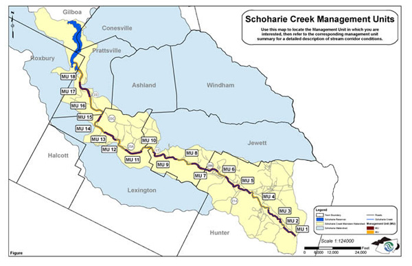
This section contains very detailed descriptions and specific recommendations for the Schoharie Creek, from the headwaters at the top of the watershed, downstream to its confluence with Schoharie Reservoir, located in the Town of Prattsville. The Schoharie Creek mainstem has been organized into 18 Management Units (MUs), defined using physical stream characteristics, historical channel alignments, location of bridges and road infrastructure, and valley characteristics (Fig. 4.0.1). These MU descriptions outline stream conditions (its bed and banks), general streamside (riparian) vegetation condition, and proximity and arrangement of roads, bridges and culverts.
Introduction
Management Unit Map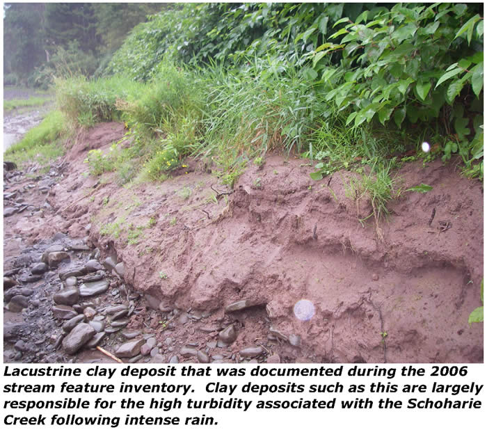
Management Unit 1
Management Unit 2
Management Unit 3
Management Unit 4
Management Unit 5
Management Unit 6
Management Unit 7
Management Unit 8
Management Unit 9
Management Unit 10
Management Unit 11
Management Unit 12
Management Unit 13
Management Unit 14
Management Unit 15
Management Unit 16
Management Unit 17
Management Unit 18
Section 5 - Demonstration Projects
Proposed Projects and Goals, 2006
Project Reporting from Completion of Proposals, 2007-2009
Lexington Culvert Replacement: Design and Implementation Report
Riparian Planting Pilot: Site Selection Guidelines
Riparian Planting Pilot: Carr Road Design and Implementation Report
Riparian Planting Pilot: Carr Road Guide to Vegetation Management
Schoharie Avenue Bank Stabilization Design and Implementation Report
Section 6 - General Recommendations
This section sets forth an extensive list of recommendations related to education and outreach, flood protection, water quality, public enjoyment, fisheries, riparian zone management, stream management, and programmatic issues, providing a frame work for watershed stakeholders to develop a long term management strategy to protect and improve the Schoharie Creek.
General Recommendations
Appendices
Appendix A Native Vegetation
Appendix B Vegetation Mapping Protocol
Riparian Vegetation Map - MU 1-3
Riparian Vegetation Map - MU 4-6
Riparian Vegetation Map - MU 7-9
Riparian Vegetation Map - MU 10-15
Riparian Vegetation Map - MU 16-18
Appendix C Complete Biodiversity Table
Appendix D Shandaken SPDES Permit
Appendix E Stream Management Data Dictionary Guide
Glossary
Schoharie Creek Management Plan Project Team
Greene County Soil & Water Conservation District 907 County Office Building, Cairo NY 12514 Phone (518) 622-3620 Fax (518) 622-0344
Abbe Martin, Project Manager
abbe@gcswcd.com |
NYCDEP Stream Management Program
71 Smith Ave, Kingston NY 124021
Phone (845) 340-7850 Fax (845) 338-1367
David Burns, Project Manager
dburns@dep.nyc.gov |
|